Khajuraho Group of Monuments: Difference between revisions
meta>Rsrikanth05 Reverted 1 good faith edit by 117.203.23.82 using STiki |
|||
| Line 85: | Line 85: | ||
Khajuraho is served by [[Khajuraho Airport]] and there is a railway station approximately six km by car from the town centre. | Khajuraho is served by [[Khajuraho Airport]] and there is a railway station approximately six km by car from the town centre. | ||
== History = | == History == | ||
In the 27th Century of Kali Yuga the Mlechcha invaders started attacking Northern India, some [[Bargujar]] moved eastward to central India; they ruled over the Northeastern region of [[Rajasthan]], called [[Dhundhar]], and were referred to as [[Dhundhel]] or [[Dhundhela]] in ancient times, for the region they governed. Later on they called themselves [[Chandela]]s; those who were in the ruling class having [[gotra]] [[Kashyap]] were definitely all Bargujars; they were vassals of Gurjara - Pratihara empire of North India, which lasted from 500 CE to 1300 CE and at its peak the major monuments were built. The Bargujars also built the [[Kalinjar]] fort and [[Neelkanth Mahadev temple]], similar to one at [[Sariska National Park]], and [[Baroli]], being [[Shiva]] | |||
The city was the cultural capital of Chandel Rajputs, a Hindu dynasty that ruled this part of India from the 10 to 12th centuries. The political capital of the Chandelas was [[Kalinjar]]. The Khajuraho temples were built over a span of 200 years, from 950 to 1150. The Chandela capital was moved to [[Mahoba]] after this time, but Khajuraho continued to flourish for some time. Khajuraho has no forts because the Chandel Kings never lived in their cultural capital. | The city was the cultural capital of Chandel Rajputs, a Hindu dynasty that ruled this part of India from the 10 to 12th centuries. The political capital of the Chandelas was [[Kalinjar]]. The Khajuraho temples were built over a span of 200 years, from 950 to 1150. The Chandela capital was moved to [[Mahoba]] after this time, but Khajuraho continued to flourish for some time. Khajuraho has no forts because the Chandel Kings never lived in their cultural capital. | ||
Revision as of 20:09, 23 May 2014
| UNESCO World Heritage Site | |
|---|---|
 | |
| Criteria | Cultural: i, iii |
| Reference | 240 |
| Inscription | 1986 (10th session) |
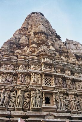
The Khajuraho Group of Monuments in Khajuraho, a town in the Indian state of Madhya Pradesh, located in Chhatarpur District, about 620 kilometres (385 mi) southeast of New Delhi, is one of the most popular tourist destinations in India. Khajuraho has the largest group of medieval Hindu and Jain temples, famous for their erotic sculptures.
Between 950 and 1150, the Chandela monarchs built these temples when the Tantric tradition may have been accepted. In the days before the Mughal conquests, when boys lived in hermitages, following brahmacharya until they became men, they could learn about the world and prepare themselves to become householders through examining these sculptures and the worldly desires they depicted.[1]
The name Khajuraho, ancient "Kharjuravāhaka", is derived from the Sanskrit words kharjura = date palm and vāhaka = "one who carries". Locals living in the Khajuraho village always knew about and kept up the temples as best as they could. They were pointed out to the English in the late 19th century when the jungles had taken a toll on the monuments. In the 19th century, British engineer T.S. Burt arrived in the area, followed by General Alexander Cunningham. Cunningham put Khajuraho on the world map when he explored the site on behalf of the Archaeological Survey of India and described what he found in glowing terms. The Khajuraho Group of Monuments has been listed as a UNESCO World Heritage Site, and is considered to be one of the "seven wonders" of India.
Town
Script error: No such module "Settlement short description".
Khajuraho | |
|---|---|
city | |
| Country | India |
| State | Madhya Pradesh |
| District | Chhatarpur |
| Elevation | Template:Infobox settlement/lengthdisp |
| Population (2011) | |
| • Total | 19,282 |
| • Density | Template:Infobox settlement/densdisp |
| Languages | |
| • Official | Hindi |
| Time zone | UTC+5:30 (IST) |
Khajuraho is a town in the Indian state of Madhya Pradesh, located in Chhatarpur District, about 620 kilometres (385 mi) southeast of New Delhi, the capital city of India. According to the 2001 India census,[2] Khajuraho has a population of 19,282. Males constitute 52% of the population and females 48%. The town has an average literacy rate of 53%, lower than the national average of 59.5%: male literacy is 62%, and female literacy is 43%. In Khajuraho, 19% of the population is under 6 years of age. Khajuraho is located at Lua error: callParserFunction: function "#coordinates" was not found.[3] and has an average elevation of 283 metres (928 feet).
Khajuraho is served by Khajuraho Airport and there is a railway station approximately six km by car from the town centre.
History
In the 27th Century of Kali Yuga the Mlechcha invaders started attacking Northern India, some Bargujar moved eastward to central India; they ruled over the Northeastern region of Rajasthan, called Dhundhar, and were referred to as Dhundhel or Dhundhela in ancient times, for the region they governed. Later on they called themselves Chandelas; those who were in the ruling class having gotra Kashyap were definitely all Bargujars; they were vassals of Gurjara - Pratihara empire of North India, which lasted from 500 CE to 1300 CE and at its peak the major monuments were built. The Bargujars also built the Kalinjar fort and Neelkanth Mahadev temple, similar to one at Sariska National Park, and Baroli, being Shiva
The city was the cultural capital of Chandel Rajputs, a Hindu dynasty that ruled this part of India from the 10 to 12th centuries. The political capital of the Chandelas was Kalinjar. The Khajuraho temples were built over a span of 200 years, from 950 to 1150. The Chandela capital was moved to Mahoba after this time, but Khajuraho continued to flourish for some time. Khajuraho has no forts because the Chandel Kings never lived in their cultural capital.
The whole area was enclosed by a wall with eight originates, each flanked by two golden palm trees. There were originally over 85 Hindu temples, of which only 25 now stand in a reasonable state of preservation, scattered over an area of about 20 square kilometres (8 sq mi). The erotic sculptures were crafted by Chandella artisans. The temples, maintained by the locals, were pointed out to the English in the late 19th century when the jungles had taken a toll on the monuments. Today, the temples serve as fine examples of Indian architectural styles that have gained popularity due to their explicit depiction of sexual life during medieval times.You can see the erotic sculptures on Kandariya Mahadev Temple.
Architecture

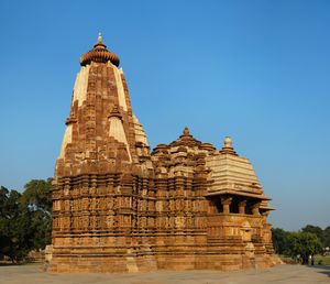
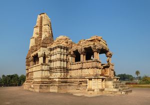
The temples are grouped into three geographical divisions: western, eastern and southern.
The Khajuraho temples are made of sandstone. The builders didn't use mortar: the stones were put together with mortise and tenon joints and they were held in place by gravity. This form of construction requires very precise joints. The columns and architraves were built with megaliths that weighed up to 20 tons.[4]
The Saraswati temple on the campus of the Birla Institute of Technology and Science in Pilani, India, is modeled after the Khajuraho temples.
Chronology
The temples have been assigned the following historical sequence by Dr. Kanhaiyalal Agrawal.[5]
| Sequence | Modern name | Original Deity | Note |
| 1 | Chausath Yogini | 64 Yoginis | Est. 9th century |
| 2 | Brahma | Brahma | Eastern group |
| 3 | Lalgun Mahadev | Shiva | Contemp to 2 |
| 4 | Matangeshwar | Shiva | In active worship |
| 5 | Varaha | Varaha | |
| 6 | Lakshmana | Vaikuntha Vishnu | Lakshavarma Inscription |
| 7 | Parshvanath | Adinath | Pahil inscription 954 AD, Jain Compound |
| 8 | Vishvanath | Shiva | Dhanga inscription Sam 1059 |
| 9 | Devi Jagadambi | Initially Vishnu but currently Parvati | |
| 10 | Chitragupta | Surya | |
| 11 | Kandariya Mahadeva | Shiva | Largest |
| 12 | Vamana | Vamana | Eastern Group |
| 13 | Adinath | Jina | Jain compound |
| 14 | Javari | Vishnu | Eastern group |
| 15 | Chaturbhuja | Vishnu | Southern |
| 16 | Duladeo | Shiva | South end |
| 17 | Ghantai | Jina | Only some columns remaining |
The Beejamandal temple is still under excavation. It has been identified with the Vaidyanath temple mentioned in the Grahpati Kokalla inscription.
Statues and carvings
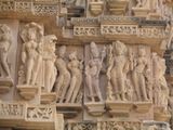
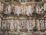
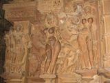
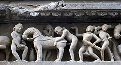
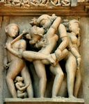
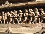
The Khajuraho temples contain sexual or erotic art outside the temple or near the deities. Some of the temples that have two layers of walls have small erotic carvings on the outside of the inner wall. It has been suggested that these suggest tantric sexual practices. Some 10% of the carvings contain sexual themes and those reportedly do not depict deities but rather sexual activities between people. The rest depict the everyday life. For example, those depictions show women putting on makeup, musicians, potters, farmers, and other folk. The mundane scenes are all at some distance from the temple deities. A common misconception is that, since the old structures with carvings in Khajuraho are temples, the carvings depict sex between deities.[6]
Another perspective of these carvings is presented by James McConnachie. In his history of the Kamasutra,(KamaSutra Ebook Download) McConnachie describes the zesty 10% of the Khajuraho sculptures as "the apogee of erotic art":
"Twisting, broad-hipped and high breasted nymphs display their generously contoured and bejewelled bodies on exquisitely worked exterior wall panels. These fleshy apsaras run riot across the surface of the stone, putting on make-up, washing their hair, playing games, dancing, and endlessly knotting and unknotting their girdles....Beside the heavenly nymphs are serried ranks of griffins, guardian deities and, most notoriously, extravagantly interlocked maithunas, or lovemaking couples."
-
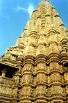
Kandariya Mahadeva temple
-
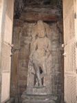
Chaturbuj Temple
-
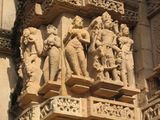
Lakshman temple
-
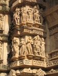
Lakshman temple
-
Lakshman temple
-
Lakshman temple
-
Lakshman temple
-
Lakshman temple
-
Erotic scene with a horse - Lakshman temple
-
A temple relief at Khajuraho in Madhya Pradesh, India features a couple in a sexual embrace with a man and a woman masturbating to either side.
-
Outside wall of one of the temples
While the sexual nature of these carvings have caused the site to be referred to as the Kamasutra temple, they do not illustrate the meticulously described positions. Neither do they express the philosophy of Vatsyayana's famous sutra. As "a strange union of Tantrism and fertility motifs, with a heavy dose of magic" they belief a document which focuses on pleasure rather than procreation. That is, fertility is moot.[citation needed]
The strategically placed sculptures are "symbolical-magical diagrams, or yantras" designed to appease malevolent spirits. This alamkara (ornamentation) expresses sophisticated artistic transcendence over the natural; sexual images imply a virile, thus powerful, ruler.[7]
Between 950 and 1150, the Chandela monarchs built these temples when the Tantric tradition may have been accepted. In the days before the Mughal conquests, when boys lived in hermitages, following brahmacharya until they became men, they could learn about the world and prepare themselves to become householders through examining these sculptures and the worldly desires they depicted.[8]
While recording the television show Lost Worlds (History Channel) at Khajuraho, Alex Evans, a contemporary stonemason and sculptor gave his expert opinion and forensically examined the tool marks and construction techniques involved in creating the stunning stonework at the sites. He also recreated a stone sculpture under 4 feet that took about 60 days to carve in an attempt to develop a rough idea how much work must have been involved.[9] Roger Hopkins and Mark Lehner also conducted experiments to quarry limestone which took 12 quarrymen 22 days to quarry about 400 tons of stone.[10] These temples would have required hundreds of highly trained sculptors.
Tourism and cultural events
The Khajuraho temple complex offers a professional light and sound show every evening. The first show is in English language and the second one in Hindi. The show is about an hour long and covers the history, philosophy and the art of sculpting of these temples. It is held in the open lawns in the temple complex.
The Khajuraho Dance Festival, held every year in the first week of February (1st to 7th), is an opportunity for visitors to experience various classical Indian dances set against the backdrop of the Chitragupta or Vishwanath Temples.
The M P Tourism Development has set up kiosks at the Khajuraho railway station (which is 9 km away from the city), with helpful tourist officers to guide the travelers. The temples in Khajuraho are broadly divided into three parts : the Eastern group, the Southern Group and the Western group of temples of which the Western group alone has the facility of an Audio guided tour wherein the tourists are guided through the seven eight temples. There is also an audio guided tour developed by the Archaeological Survey of India which includes a narration of the historical data related to the temples.
See also
- Bambar Baini the famous temple located on a hill in Laundi.
- Kandariya Mahadeva
- Hemvati
- Beejamandal
- Jain temples of Khajuraho
- List of megalithic sites
- Bandhavgarh National Park
- tribes india khajurahothe famous tribal government shop.
- Badami Chalukya architecture, Western Chalukya architecture
References
- ↑ Khajuraho
- ↑ Template:GR
- ↑ Falling Rain Genomics, Inc - Khajuraho
- ↑ "Lost Worlds of the Kama Sutra" History channel
- ↑ Khajuraho, Kanhaiyalal Agrawal, Macmillan India, 1980 (in Hindi)
- ↑ "Khajuraho", liveindia.com
- ↑ McConnachie, James (2005). The Book of Love, the Story of the Kamasutra. Metropolitan Press. pp. 46–47.
- ↑ Khajuraho
- ↑ "Lost Worlds of the Kama Sutra," History Channel
- ↑ Lehner, Mark, The Complete Pyramids, London: Thames and Hudson (1997) p. 202-225 ISBN 0-500-05084-8.
Further reading
- L. A. Narain, Khajuraho: Temples of Ecstasy. New Delhi: Lustre Press (1986)
- Phani Kant Mishra, Khajuraho: With Latest Discoveries, Sundeep Prakashan (2001) ISBN 81-7574-101-5
- Devangana Desai, The Religious Imagery of Khajuraho, Franco-Indian Research P. Ltd. (1996) ISBN 81-900184-1-8
- Devangana Desai, Khajuraho, Oxford University Press Paperback (Sixth impression 2005) ISBN 978-0-19-565643-5
External links
![]() Khajuraho travel guide from Wikivoyage
Khajuraho travel guide from Wikivoyage
- Pages with non-numeric formatnum arguments
- Articles with hatnote templates targeting a nonexistent page
- Missing redirects
- Pages using infobox UNESCO World Heritage Site with unknown parameters
- Pages using infobox settlement with unknown parameters
- All articles with unsourced statements
- Articles with unsourced statements from August 2012
- Articles with invalid date parameter in template
- Articles needing additional references from August 2012
- All articles needing additional references
- Commons category link is locally defined
- Hindu World Heritage Sites
- Hindu holy cities
- Bundelkhand
- Monuments and memorials in Madhya Pradesh
- Chhatarpur district
- World Heritage Sites in India
- Khajuraho
